By David Jacobson, Temblor
Click here to protect yourself from natural disasters

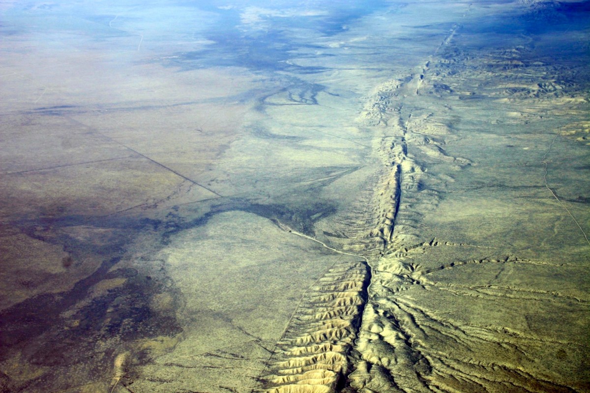
In a manuscript accepted for publication yesterday, new evidence for 10 ground-rupturing earthquakes prior to 1857, along the Big Bend of the Southern San Andreas Fault was presented. The study, headed by Dr. Katherine Scharer at the USGS in Pasadena, examined the earthquake history of the San Andreas near Frazier Mountain in northeast Kern County. This area last ruptured in the 1857 M=7.7-7.9 Fort Tejon earthquake.

One of the reasons why this location is of importance is because in Southern California, the Big Bend, Carrizo, and Mojave sections of the San Andreas Fault accommodate 50-70% of plate motion. This means that the seismic hazard is high. While the Mojave section to the south ruptures on average, every 100-135 years, by knowing more about the overall region, more can be said about the extent and magnitude of past ruptures. Therefore, by piecing together the earthquake history along various sections of the San Andreas, it is the hope that the seismic hazard will be better understood.

In order to complete this study, over 30 trenches were excavated, in which the structural and sedimentological evolution of the area could be documented. The Frazier Mountain site along the San Andreas is a pull-apart basin, meaning that through successive ruptures over the last 1200 years, the basin has grown and been ripped apart numerous times, allowing for distinct earthquake horizons to form. These horizons often appear as small tears, large cracks, and/or folding. Because of this range, the degree of certainty as to whether a horizon has been found, varies. Nonetheless, at this site, 11 horizons dating back to 800 A.D. were identified. Such precise dating was accomplished by dating charcoal and plant remains found at each horizon.

By using the timing of these prehistoric earthquakes, Dr. Scharer and her team determined that the average interval between quakes along the Big Bend section is approximately 100 years. However, intervals as short as 22 years and as long as 186 years were also noted. Additionally, 66% of the intervals are shorter than the current one, which sits at 160 years. It should be noted that the USGS forecasts there is a 16% chance a M=7.5+ earthquake will strike this portion of the San Andreas in the next 30 years. This new study presented facts suggesting that most earthquakes along the Big Bend section are M=7.0-7.5. While quakes can exceed M=7.5, as was seen in the 1857 rupture, only one other earthquake in the last 700 years reached such a magnitude.
In addition to determining the approximate interval and magnitude of earthquakes along the Big Bend Section, the team was able use the earthquake record from the Mojave Section to determine other earthquake characteristics. By comparing the timing of events along both sections, Dr. Scharer was able to determine that at most, ruptures along the San Andreas span both the Mojave and Big Bend sections, 50% of the time in M=7.3+ earthquakes.
Overall, this new evidence for ground-rupturing earthquakes along the Big Bend section of the San Andreas Fault provides useful data to determine how and when the fault ruptures. The characteristics seen in the fault here are similar to other locations along the San Andreas. Therefore, hopefully as more studies like this are completed, we can gain a greater understanding of the seismic hazard of the San Andreas Fault, “In order to properly design infrastructure, like highways, water and power lines, so that it can survive the next earthquake,” Scharer said.
References
Scharer, K., R. Weldon, G. Biasi, A. Streig, and T. Fumal (2017), Ground-rupturing earthquakes on the northern Big Bend of the San Andreas Fault, California, 800 A.D. to present, J. Geophys. Res. Solid Earth, 122, doi:10.1002/2016JB013606. Link
USGS Press Release – Link
- Remembering Tom Hanks (1944 – 2024) - April 30, 2024
- Seismology for Society: A Q&A with Dr. Lucile Jones, the 2023 Beno Gutenberg Lecturer - April 23, 2024
- Magnitude 4.8 earthquake shakes the U.S. East Coast - April 10, 2024