By David Jacobson and Ross Stein, Temblor
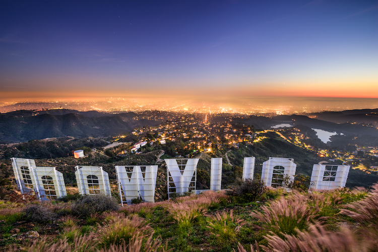
On 13 July, the California Geological Survey released four preliminary Earthquake Fault Zone maps for parts of Los Angeles and Napa counties. The West Los Angeles coverage provides new active fault ‘traces’ (where a fault intersects the Earth’s surface) and ‘zones’ (the areas in which some faulting could occur in an earthquake) for the Santa Monica Fault, the Hollywood Fault, and the Newport-Inglewood Fault. And, yes, the Hollywood Fault is responsible for lifting up one of L.A.’s most sacred landmarks, the “Hollywood” sign atop the Santa Monica Mountain range.
New Fault Zone Mapping
Because fault sections were added, revised, and removed, hundreds of billions of dollars of real estate are impacted by these new boundaries. This work is carried out under California law; if property lies within the Alquist-Priolo Earthquake Fault Zones that generally extend 150 meters to each side of a fault, special investigation is required prior to construction. These are preliminary review maps, which will not become official until at least January 11, 2018, but provide a chance to see what new fault research has revealed about the Hollywood, Santa Monica, and Newport-Inglewood Faults, which traverse a wealthy, densely-populated urban corridor.

The Fault Zones limit residential and commercial development
Alquist-Priolo Zones are defined as regulatory perimeters around active faults. According to Tim Dawson, a senior engineering geologist for the California Geological Survey, these zones are “intended to capture the most hazardous faults that could produce surface displacements of concern to a building.” While a fault rupture can be confined to zones just a few meters (10 ft), because of the uncertainty of the fault location and the possibility of slip on a distributed band of faults, the state makes the zones ~150 meters (500 ft) on either side of the mapped trace of a fault.
If a property is within a Fault Zone, strict guidelines must be followed if new construction or major renovations are planned. Further, development is prohibited directly on active faults found within these zones . All of this is done to ensure public safety. Therefore, new maps like the ones released last week will have significant impacts.

High resolution fault mapping is extremely difficult in densely populated and heavily landscaped areas. Brian Olson, a California Geological Survey engineering geologist used existing maps, radar topographic imagery (LIDAR), old aerial photos, and field observations.
Dr. Rufus Catchings of the U.S. Geological Survey performed a shallow geophysical survey that determined the subsurface geometry of the Santa Monica Fault in the vicinity of the Veterans Administration Hospital (Catchings et al., 2008).
Additionally, Tim Dawson said that, “Professor James Dolan at USC conducted a paleoseismic investigation at the Veterans Administration Hospital on the Santa Monica fault. Other faults studies have been conducted by consultants at schools in the area, as well as other studies done for the proposed LA Metro Purple Line Subway Extension.” In the map above, the old and new fault traces and Alquist-Priolo (A-P) Zones are shown to illustrate the changes. One of these changes is the addition of a 6.3 km2 zone cutting through Beverly Hills, Westwood and Santa Monica.
Which fault sections disappeared, and which were added?
The southernmost 5 km (3 mi) section of the Santa Monica Fault, which formerly sliced through a coveted beach community, has been removed. The fault should have been visible in the Santa Monica bluff face, and probably was not found. This trace also was not expressed in the topography, another clue that it had been mislocated. The central two sections remained, and a new one was added to the north. So, the fault is now seen to be closer to the range front of the Santa Monica Mountains.
Prior to the new mapping, there were four discontinuous faults running through Santa Monica. Now, the 5-km-long (3 mi) northern-most section of the Newport-Inglewood Fault, which ruptured in the 1933 M=6.4 Long Beach earthquake, has been removed entirely, and so the Newport-Inglewood and Santa Monica Faults are no longer connected.
What does this mean for earthquake rupture?
But there is now more connectivity and continuity between the Hollywood and Santa Monica Faults, making a through-going rupture more likely, which, if it encompassed the adjacent Raymond Fault could reach Magnitude~7. On the other hand, the possibility of a joint rupture of the northern Newport-Inglewood and Santa Monica Faults is now diminished. The revised 12 km-long fault section of the Santa Monica fault has a high degree of continuity, permitting a M≤6.7 rupture, similar to the 1971 San Fernando or 1994 Northridge earthquake.
Fault traces to green belts
Wouldn’t it be ideal if all these fault traces were turned into green belts? This would be the most appropriate and most valuable use of this land.

The Right Stuff
These changes in fault traces highlight the importance of continually researching and remapping urban faults, as only with better knowledge can we prepare for the earthquakes which will inevitably happen. Nowhere is this more difficult—or more important—than in dense urban areas like this one.
References
California Geological Survey Press Release dated July 13, 2017: Link
California Geological Survey PDF Map for Preliminary Review: Link
Webpage for the Alquist-Priolo Earthquake Fault Zoning Act: Link
Rong-Gong Lin II and Raoul Rañoa, ‘Earthquake fault maps for Beverly Hills, Santa Monica and other Westside areas could bring development restrictions’ (Los Angeles Times, 13 July 2017): Link
R. D. Catchings, G. Gandhok, M. R. Goldman, D. Okaya, M. J. Rymer, and G. W. Bawden, Near-Surface Location, Geometry, and Velocities of the Santa Monica Fault Zone, Los Angeles, California, Bulletin of the Seismological Society of America, Vol. 98, No. 1, pp. 124–138, February 2008, doi: 10.1785/0120020231.
Olson, Brian, 2017, The Hollywood, Santa Monica, and Newport-Inglewood Faults in the Beverly Hills and Topanga 7½-minute Quadrangles, Los Angeles County, California: California Geological Survey, Fault Evaluation Report #259, 72 pages of text and figures; Plate 1, Compilation of Historical Fault Mapping; Plate 2, Geomorphology of Beverly Hills and Topanga Quadrangles; Plate 3, Recommended Fault Zones for Hollywood Fault, Newport-Inglewood Fault, and Santa Monica Fault.
Acknowledgements
We would like to thank Tim Dawson (California Geological Survey) and Robert H. Sydnor for reviewing this post and for providing valuable insight. We also thank Mark Benthien (SCEC) for comments that inspired revisions to the originally posted article.
- Earthquake science illuminates landslide behavior - June 13, 2025
- Destruction and Transformation: Lessons learned from the 2015 Gorkha, Nepal, earthquake - April 25, 2025
- Knock, knock, knocking on your door – the Julian earthquake in southern California issues reminder to be prepared - April 24, 2025