By David Jacobson, Temblor
A M=7.0 earthquake shook off the coast of Fiji yesterday, and might have triggered triggered a remote aftershock over 1,000 km away. In addition to producing strong shaking at the offshore epicenter, a tsunami threat was briefly issued. Even though the quake was over 200 km southwest of the capital of Suva, power cuts were seen across the island.

This earthquake occurred in one of the most seismically active regions on earth, between the Australian and Pacific plates. To the west of the epicenter is the North New Hebrides Trench, and to the east, the Tonga Trench. These two subduction zones consistently produce large magnitude earthquakes. However, the region in which yesterday’s quake took place is relatively inactive and can be seen below.
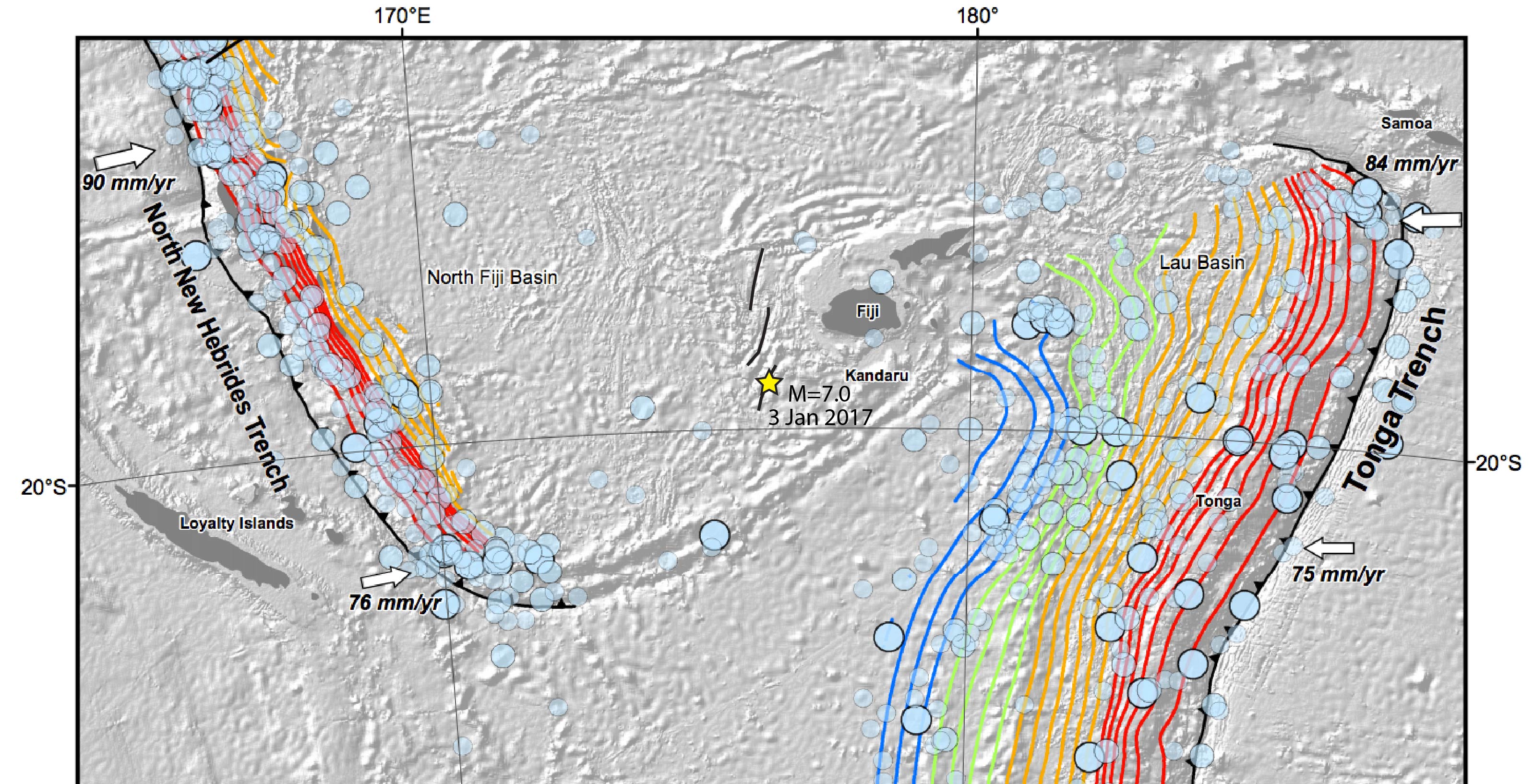
While the region as a whole is undergoing compression, yesterday’s event had normal fault motion, which is likely due to back-arc spreading. Additionally, these two subduction zones are loosely connected by a system of smaller faults with variable motion.
Based on the Global Earthquake Activity Rate (GEAR) model, the magnitude of this quake is slightly surprising. The model suggests that the likely magnitude in your lifetime is 6.25-6.5. This number is generated from the last 38 years of global seismicity, and strain rates from stations around the world.

In addition to localized seismicity, yesterday’s M=7.0 earthquake could have generated a quake hundreds of kilometers away. While there were 14 aftershocks of M=4.9+ in close proximity to the mainshock, there was also a M=5.6 earthquake 3 hours after the mainshock, approximately 1,000 km away. This quake, off the coast of Vanuatu, could be a remotely triggered aftershock, in an area of high seismicity. Based on the last 30 days of earthquakes along the North New Hebrides Trench, there have only been only four shallow quakes, including the one yesterday, which had a depth of 10 km. Therefore, while it is possible that the timing of the M=5.6 is coincidental, it could be a remotely triggered aftershock.
Sources:
USGS
European Mediterranean Seismological Centre (EMSC)
- Earthquake science illuminates landslide behavior - June 13, 2025
- Destruction and Transformation: Lessons learned from the 2015 Gorkha, Nepal, earthquake - April 25, 2025
- Knock, knock, knocking on your door – the Julian earthquake in southern California issues reminder to be prepared - April 24, 2025