By David Jacobson, Temblor
See earthquakes in El Salvador

A M=6.2 earthquake struck off the coast of El Salvador at 4:41 a.m. local time this morning (12 May 2017). According to the USGS, the quake occurred at a depth of 10 km, approximately 75 km offshore. So far, no reports of damage have come in, and the USGS estimates that economic losses should remain minimal, and that there should be no fatalities as only light shaking was felt in the country, including in the capital city of San Salvador, which is home to over 250,000 people.
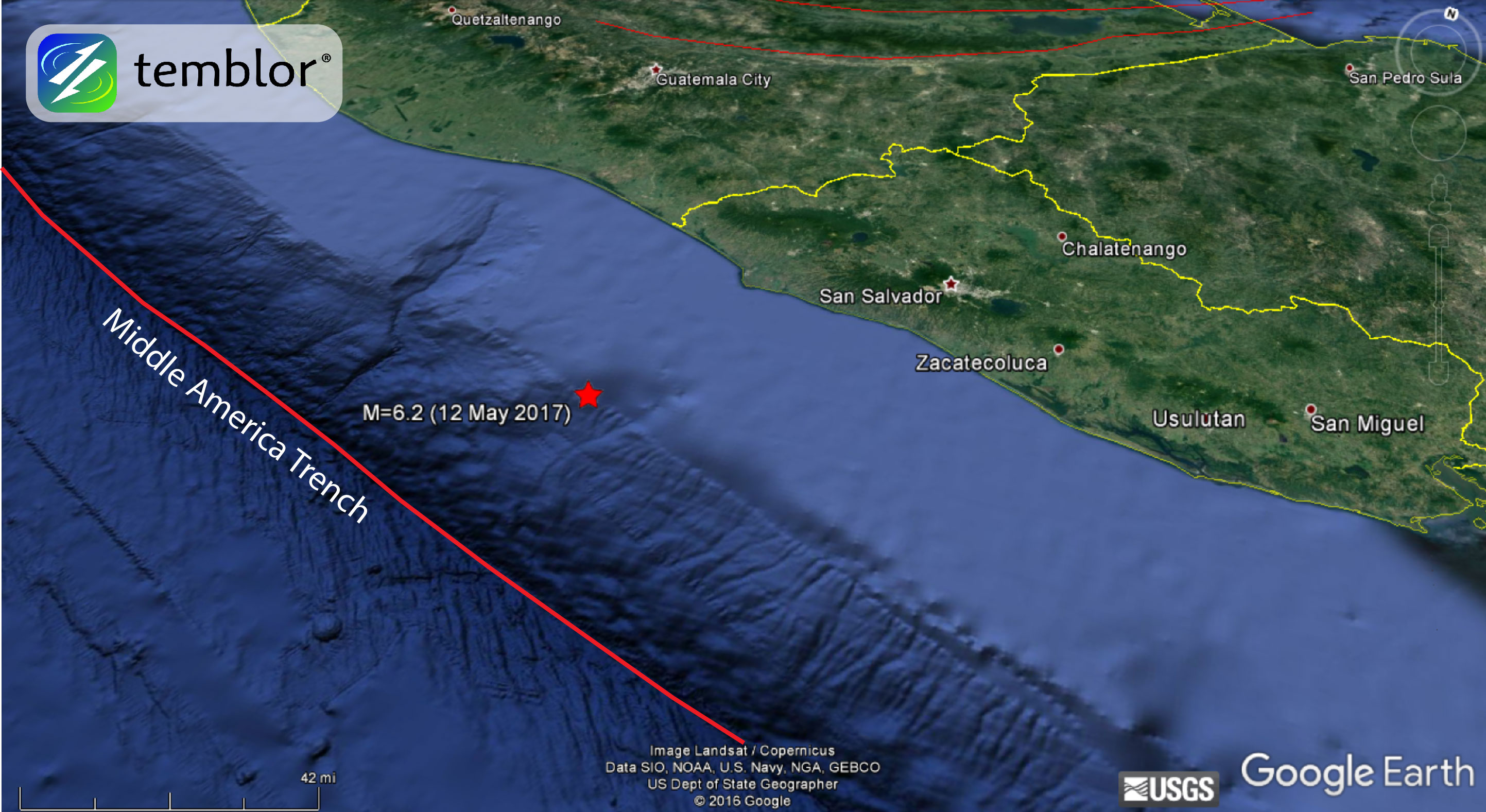
Even though the USGS does not have a focal mechanism, based on the earthquake’s depth and location, it likely occurred on the Central American subduction zone or just above it. This analysis was also aided by using the Slab 1.0 model by Gavin Hayes at the USGS (which appears in Temblor as “Megathrust” zones). This model is a compilation of global subduction zones geometries. Based on the geometry of this subducting slab, it should be at a depth of 10-20 km in the location of today’s event.
The Central American subduction zone is a product of the Cocos plate subducting beneath the Caribbean plate at the Middle American Trench at a rate of 72-81 mm/yr. This convergence decreases from south to north, and in the location of today’s quake, the rate is approximately 81 mm/yr. Because of this subduction, there is both a high rate of seismicity throughout Central America, as well as a chain of active volcanoes.
This portion of Central America is no stranger to large earthquakes. In 2001, a M=7.7 offshore of El Salvador, also on the subduction zone, claimed nearly 1,000 lives, generated thousands of landslides, and caused millions in damage. By using the Global Earthquake Activity Rate (GEAR) model, which is available in Temblor, we can determine if today’s quake should be considered surprising or not. The GEAR model uses global strain rates and seismicity since 1977 to forecast the likely earthquake magnitude in your lifetime anywhere on earth. From the GEAR model shown below, we can see that the region is susceptible to M=7.25+ earthquakes, meaning today’s M=6.2 should not be considered alarming. Instead, it should come as a reminder that Central America is highly seismically active. To view the GEAR model, click here.

References
USGS
Hayes, G. P., D. J. Wald, and R. L. Johnson (2012), Slab1.0: A three-dimensional model of global subduction zone geometries, J. Geophys. Res., 117, B01302, doi:10.1029/2011JB008524.
- Earthquake science illuminates landslide behavior - June 13, 2025
- Destruction and Transformation: Lessons learned from the 2015 Gorkha, Nepal, earthquake - April 25, 2025
- Knock, knock, knocking on your door – the Julian earthquake in southern California issues reminder to be prepared - April 24, 2025