By David Jacobson, Temblor
See earthquakes in the Philippines

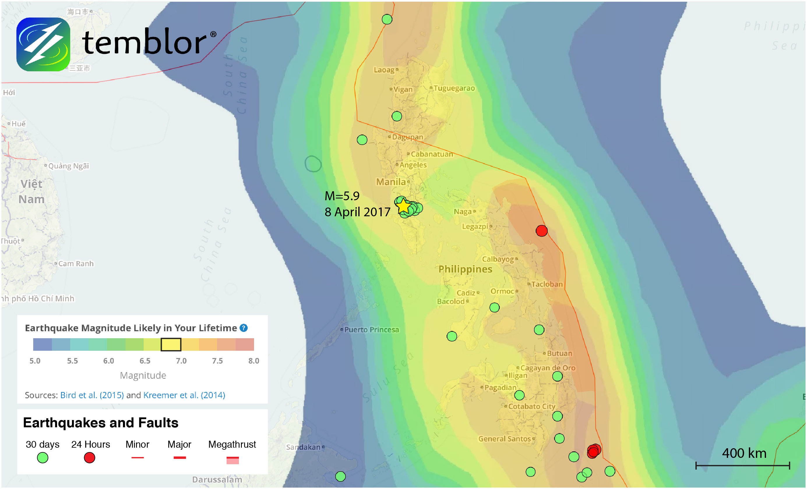
On Saturday (8 April 2017), a M=5.9 earthquake shook the northern Philippines, including the capital city of Manila, which is home to over 1.5 million people. According to the USGS, the quake occurred at a depth of 42 km, and registered moderate shaking near the epicenter. In Batangas, close to the epicenter, there were both power cuts and minor damage, while in Manila 100 km north, weak shaking was felt.
While there are several faults in the region, notably the Marikina Valley Fault System, Lubang Fault and Aglubang River Fault, this quake does not appear to have occurred along any of them. Even though the Lubang Fault is only 13 km from the mapped epicenter, its sense of slip does not match Saturday’s quake. While the Lubang Fault is left-lateral, the focal mechanism from Saturday’s quake indicates it was right-lateral in nature, suggesting an alternative source.

In addition to being the wrong focal mechanism, this quake occurred at a depth of 42 km, meaning it was likely below the Lubang Fault. Because the Philippines is flanked on either side by subduction zones, this portion of the country is undergoing left-lateral shear. Furthermore, the distortion of the Manila Trench means that in the vicinity of the quake, the subduction zone is more likely a transform or oblique boundary due to prevailing plate motion vectors. This means that the quake likely occurred within the Eurasian Plate as it subducts beneath the Philippine Plate, and represents a small tear in the slab.
It should also be pointed out that this region is home to Taal Volcano, which is the second most active volcano in the Philippines, and is considered a ‘Decade Volcano’ due to its proximity to the city of Manila. This area represents a zone of extension where young volcanism is present. While the extension in the region likely didn’t influence the quake, it does show how many tectonic forces are at play in this part of the Philippines.
Lastly, according to the Global Earthquake Activity Rate (GEAR) model, which uses global strain rates and seismicity since 1977, this earthquake should not be considered a surprise. This model forecasts that in your lifetime, a M=6.75+ earthquake will occur in this region of the Philippines. To see what the likely earthquake magnitude in your lifetime anywhere on earth, click here.
References
USGS
G-EVER (Philippines Faults) Link
- Earthquake science illuminates landslide behavior - June 13, 2025
- Destruction and Transformation: Lessons learned from the 2015 Gorkha, Nepal, earthquake - April 25, 2025
- Knock, knock, knocking on your door – the Julian earthquake in southern California issues reminder to be prepared - April 24, 2025