By David Jacobson, Temblor
See earthquakes in East Africa

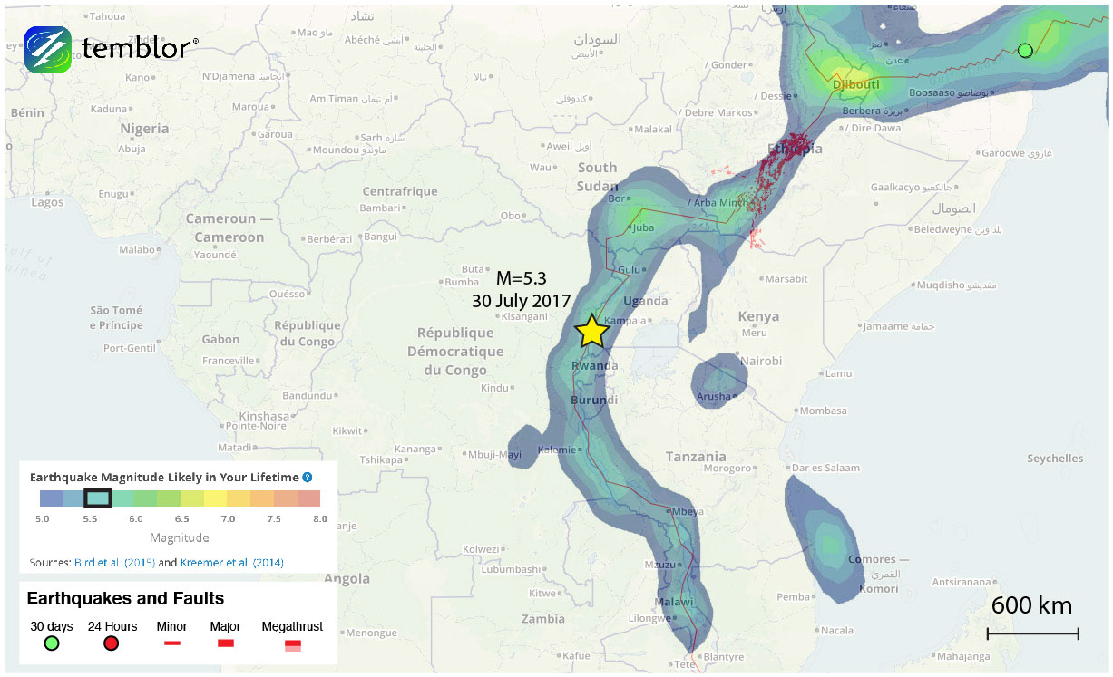
Yesterday, at just past 10 a.m. local time, a M=5.3 earthquake struck southwestern Uganda, along the East African Rift Valley. The quake’s epicenter was located along the western shores of Lake Edward, at a depth of 10 km. Fortunately, this quake did not occur near a populated area, and there are therefore no reports of damage or fatalities. However, given the magnitude of this quake, had it struck closer to a town or city, damage could have resulted.

The East African Rift is a 3,000 km-long system extending from Djibouti to western Mozambique. While there are other rifting systems around the world, this is the only one that is active on a continent-wide scale, which means scientists have the ability to actively and easily study it. Additionally, they have the ability to compare continental rifting to oceanic spreading. Seismicity along the rift is dominated by shallow extensional faulting, and volcano-tectonic earthquakes. Unfortunately, the USGS does not have a focal mechanism for yesterday’s earthquake, and because of the active volcanoes in the region, we cannot be sure what the sense of slip was.
Even though yesterday’s earthquake was not very substantial in magnitude, large quakes can occur throughout the rift system. For example, in 2006, a M=7.0 quake occurred in Mozambique, which killed 2 people, and left another 15 injured. Therefore, much of eastern Africa has a moderate seismic hazard. By using the Global Earthquake Activity Rate (GEAR) model, which is available in Temblor, we can see this threat. This model uses global strain rates and seismicity from the last 40 years to determine the likely earthquake magnitude in your lifetime anywhere on earth. From the figure below, one can see that in this portion of the rift, a M=5.5+ is likely in your lifetime. Therefore, yesterday’s quake should not be considered surprising.
References
USGS
European-Mediterranean Seismological Centre
- Earthquake science illuminates landslide behavior - June 13, 2025
- Destruction and Transformation: Lessons learned from the 2015 Gorkha, Nepal, earthquake - April 25, 2025
- Knock, knock, knocking on your door – the Julian earthquake in southern California issues reminder to be prepared - April 24, 2025