By David Jacobson, Temblor
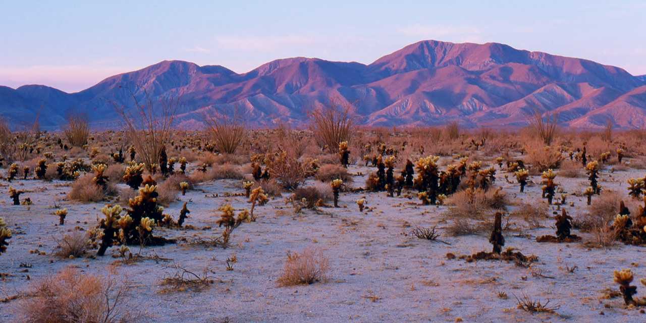
Yesterday morning, a M=3.2 earthquake struck the southern tip of the San Jacinto Fault near Superstition Mountain. The quake occurred at a depth of 11 km, and was nearly pure strike-slip in nature, consistent with movement along the San Jacinto Fault. Because this part of Southern California is sparsely populated, few to no people felt this earthquake, in one of the more seismically hazardous regions in the state. On the USGS website, three people reported feeling it, though given their distance from the epicenter, the reports are not accurate.
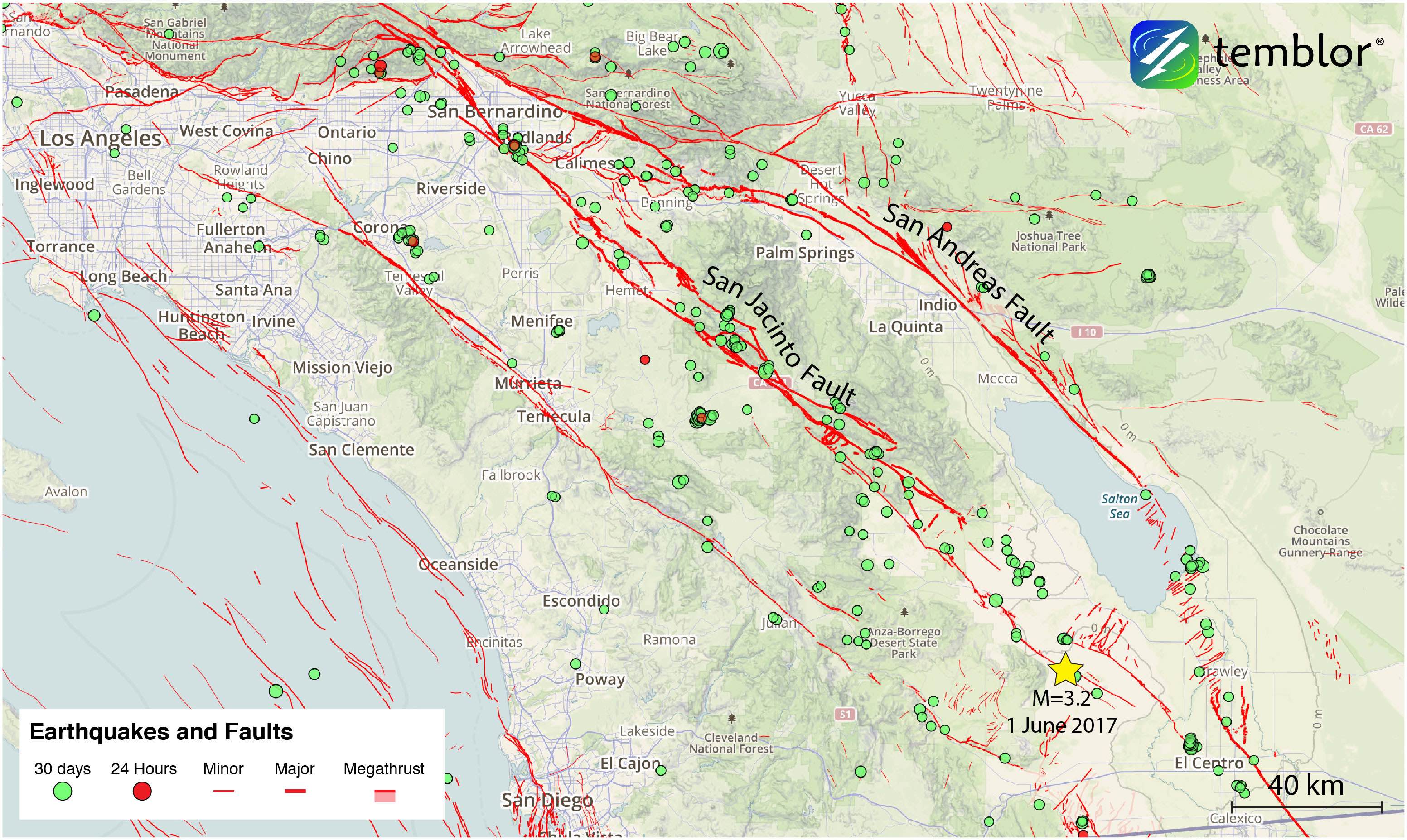
The San Jacinto Fault branches off the San Andreas Fault just northwest of San Bernardino, and extends for over 200 km through Southern California. The San Jacinto has a yearly slip rate of 7-17 mm, and when combined with the San Andreas, these two faults accommodate the majority of stress between the North American and Pacific plates. Because of this, the San Jacinto shows regular signs of seismicity. Additionally, while the San Andreas is capable of larger earthquakes than the San Jacinto, smaller magnitude earthquakes are more common on the San Jacinto, as is evident by the Temblor map above.
Over the last 50 years, the San Jacinto Fault has only seen one major surface-faulting event, the 1968 Borrego Mountain earthquake. However, this M=6.5 quake was extremely remote and did not cause damage. Additionally, just to the east, the Superstition Hills Fault, which is part of the San Jacinto Fault Zone ruptured in 1987 in a M=6.6 earthquake. So, the region is capable of large quakes, and the Southern California Earthquake Data Center estimates that the San Jacinto Fault could generate earthquakes reaching M=7.5. In fact, there is some evidence that shows that the M=7.5 earthquake in 1812 ruptured the northern segment of the San Jacinto. A repeat of such an event along the northern segment, which runs through San Bernardino would be devastating to Southern California.
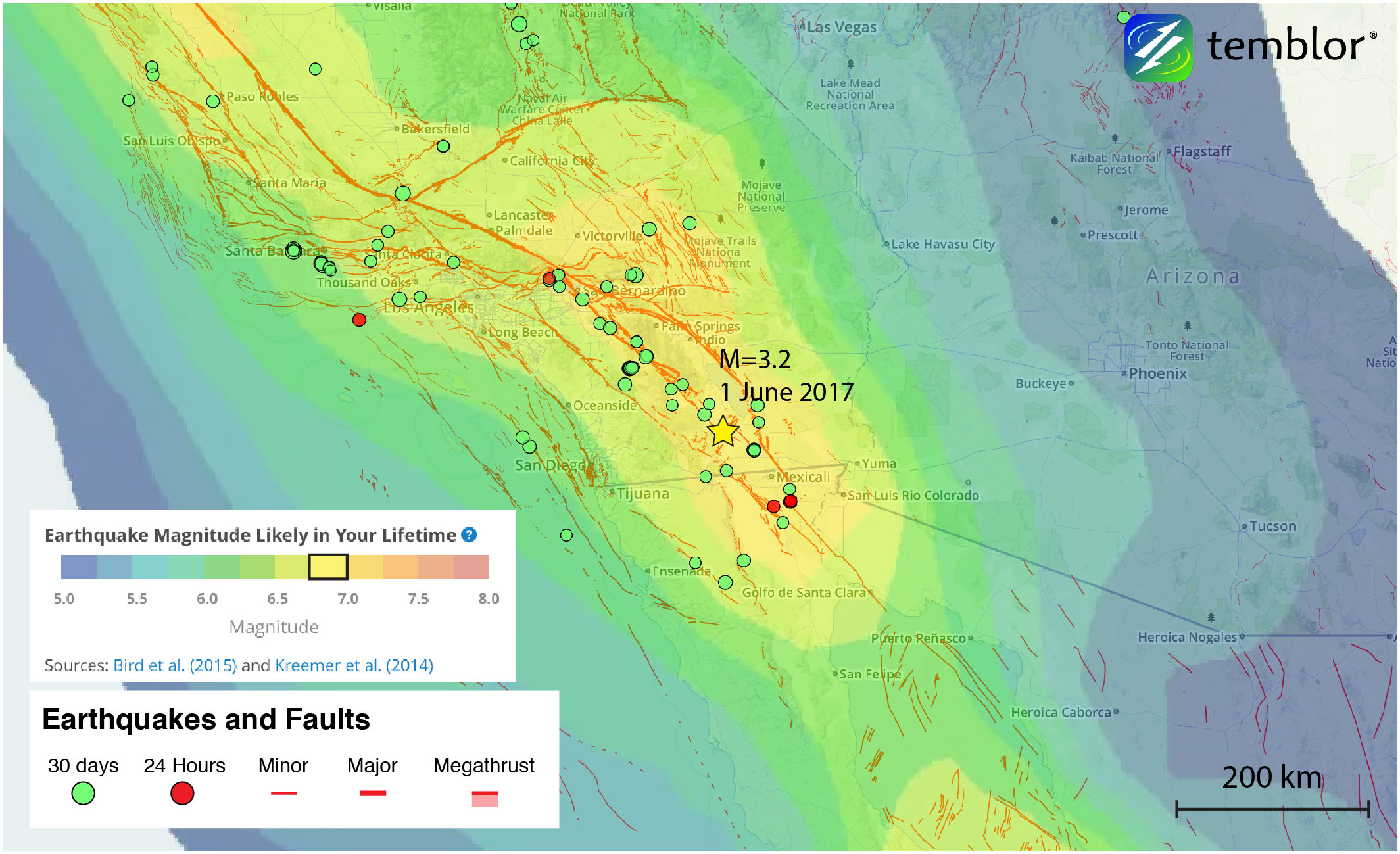
According to the Global Earthquake Activity Rate (GEAR) model, a moderate earthquake is likely to occur in this portion of Southern California in your lifetime. This model uses global strain rates and seismicity since 1977 to forecast likely earthquake magnitudes anywhere on earth. From the Temblor image below, one can see that around the location of yesterday’s earthquake, a M=6.75 quake is likely. Therefore, understanding the seismicity and potential hazards associated with the San Jacinto Fault is important.
References
USGS
Southern California Earthquake Data Center
- Earthquake science illuminates landslide behavior - June 13, 2025
- Destruction and Transformation: Lessons learned from the 2015 Gorkha, Nepal, earthquake - April 25, 2025
- Knock, knock, knocking on your door – the Julian earthquake in southern California issues reminder to be prepared - April 24, 2025