By David Jacobson, Temblor
Yesterday, in the southern Gulf of California, there were 11 M=3.4+ earthquakes in the span of a little more than eight hours. The largest of these were two M=4.6 quakes approximately 100 km offshore of both Baja California and Mexico. Because of the magnitude of these quakes, and their location relative to populated areas, they were not felt and caused no damage. Nonetheless, they highlight the Gulf’s intense seismicity, which is tied to its evolution as an oblique rifting system.

In order to understand why Baja California is slowly rifting off of mainland Mexico, forming an ocean basin, we have to go back 20 million years. Over this time period, the Pacific plate has slid northwest relative to the North American plate. In the United States, this nearly pure strike-slip motion created the San Andreas Fault, which helped form the Transverse Ranges, and is slowly dragging parts of Southern California northward. To the south of the Gulf of California is the East Pacific Rise, a purely divergent plate boundary. Because of the varying motion to the north and south, the Gulf of California represents a transitional corridor where transform faults links spreading ridges. While not always the case, the earthquakes near the transform faults tend to be right-lateral in nature, while those close to the spreading centers are normal (extensional) events. These strike-slip earthquakes also tend to be larger than the extensional ones as more stress can build up along these margins. Unfortunately, for yesterday’s quakes, we do not have focal mechanisms and can therefore not say which are strike-slip and/or extensional events. However, according to Castro et al., 2017, seismicity in the southern Gulf of California is dominated by earthquakes along strike-slip faults.
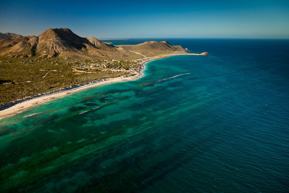
While this rift system is largely hidden from view, when the bathymetry of the Gulf of California is viewed, the faults stand out (see below). In this Google Earth imagery, the spreading centers can be clearly seen to trend northeast-southwest, while the transform faults run northwest-southeast, with orientations similar to the San Andreas Fault. What is also evident from this figure is that the system is much more defined in the south than in the central portion of the Gulf. This is because the southern Gulf of California is much more active due to rapid rupture.

According to Paul Umhoefer at Northern Arizona University, this rapid rupture comes down to three factors: a thin zone of hot, weak crust, moderately rapid plate motion, and the oblique nature of plate motion. This hot, weak crust is due to multiple magmatic and deformation events in the millions of years prior to rifting. These characteristics also mean that much of the rifting within the Gulf of California only took 6-10 million years, a short period of time in geologic terms. Compare this to the 30-80 million years it often takes for rifting continents to open up, and it becomes clear that the Gulf of California is a special case.
Even though yesterday’s quakes within the Gulf of California were by no means significant in terms of their societal impact, their location allowed us to highlight a tectonically important region off the coast of Baja California and Mexico, which is prone to moderately large earthquakes. According to the Global Earthquake Activity Rate (GEAR) model, which is available in Temblor, in your lifetime, the likely earthquake magnitude for this location is M=6.5+. This model uses global strain rates and past seismicity to forecast future events. While M=6.5+ earthquakes may seem large, it should be pointed out that for the most part, earthquakes within the Gulf will not be damaging and are seen as more of a nuisance, due to their lack of proximity to populated areas. The main exception to this is at the northern end of the Gulf, where the system transitions to a continental boundary near California’s Imperial Valley. Therefore, the region is closely monitored by an array of ocean-bottom and continental seismographs.

References
EMS Catalog
USGS
IRIS
Castro, R.R., et al., Active tectonics in the Gulf of California and seismicity (M > 3.0) for the period 2002–2014, Tectonophysics (2017), http://dx.doi.org/10.1016/j.tecto.2017.02.015
Paul J. Umhoefer, Why did the Southern Gulf of California rupture so rapidly?—Oblique divergence across hot, weak lithosphere along a tectonically active margin, GSA TODAY, Volume 21 Issue 11 (November 2011).
- Earthquake science illuminates landslide behavior - June 13, 2025
- Destruction and Transformation: Lessons learned from the 2015 Gorkha, Nepal, earthquake - April 25, 2025
- Knock, knock, knocking on your door – the Julian earthquake in southern California issues reminder to be prepared - April 24, 2025