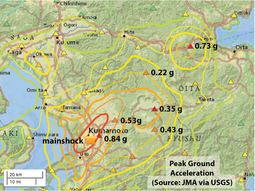
Preliminary map of observed (triangles) and inferred (contours) shaking from the Mw=7.0 event, from the USGS. The contours blend a model and data. The shaking appears to be much stronger to the northeast, suggesting how the 40 km long fault ruptured (or, unzipped).
Latest posts by Temblor (see all)
- When Tokyo’s next big earthquake hits, could global markets crash? - March 20, 2026
- The Earthquake that Shook the South - February 26, 2026
- Introducing Coulomb 4.0: Enhanced stress interaction and deformation software for research and teaching - February 20, 2026