
Tsunami early warning systems offer important information about impending waves. New systems can increase the timeliness and accuracy of warnings.
By Rebecca Owen, Science Writer (@beccapox and @beccapox.bsky.social)
Citation: Owen, R., 2025, Upgrading Tsunami Warning Systems for Faster and More Accurate Alerts, Temblor, http://doi.org/10.32858/temblor.369
A rupturing fault sends out crucial information through seismic waves. Sensors detect the initial P-wave and capture data pertaining to the earthquake’s size, location, and depth. On the West Coast of the U.S., if the earthquake is large enough, the ShakeAlert System is triggered and a message is delivered to the public. This alert can provide a few precious seconds for people to take protective action during or, preferably, before the slower and potentially damaging S-wave arrives. The alert is not a prediction because it doesn’t offer a warning before the earthquake actually starts.
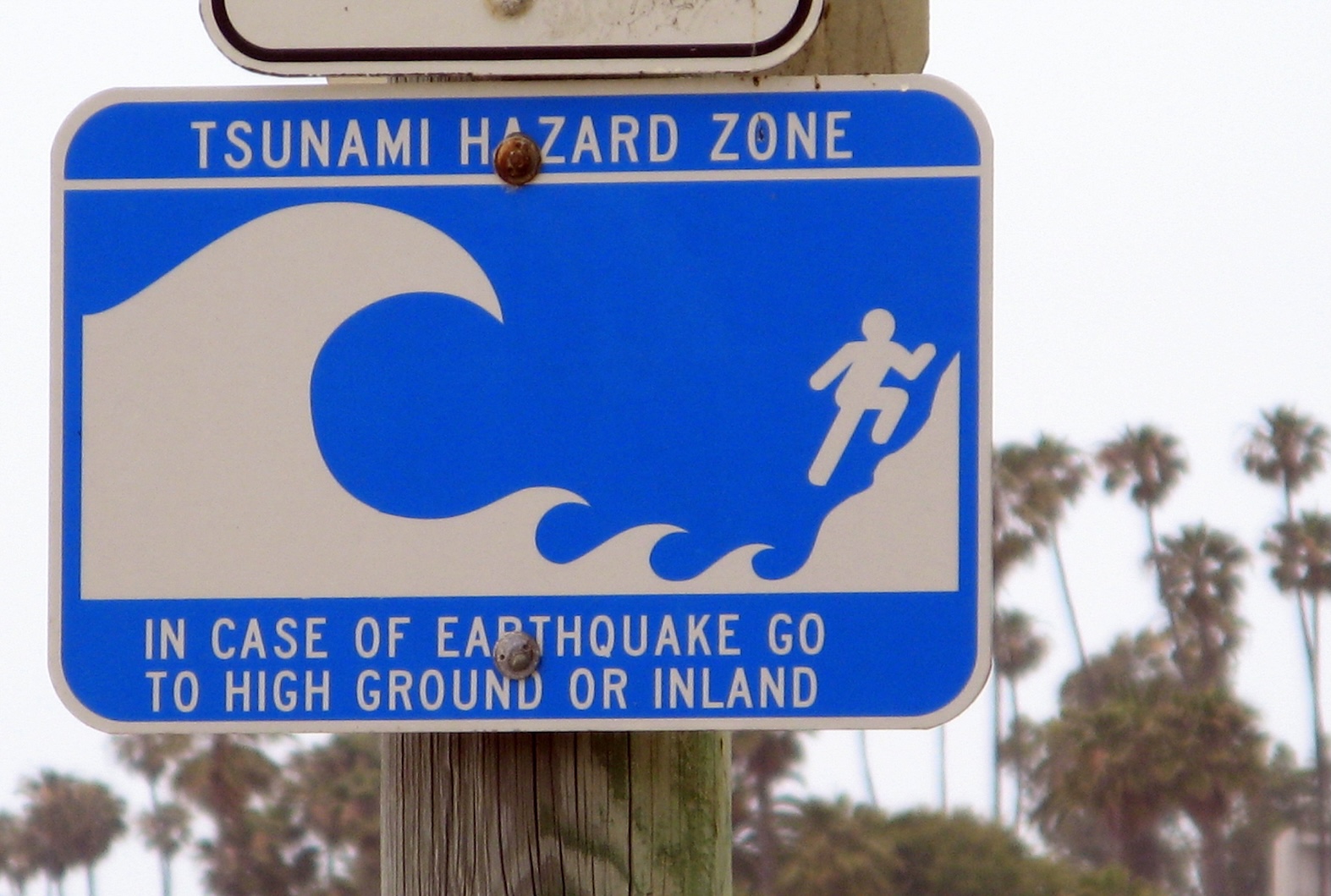
For coastal areas where the dual threat of earthquake and tsunami exists, an earthquake itself may be the only warning that a tsunami might be on the way. Although this is one way for tsunamis to be generated, it’s not the only cause. Any event that displaces a large column of seawater — underwater volcanic eruptions, submarine landslides, or offshore earthquakes — can create tsunamis.
Unlike earthquake early warning systems like ShakeAlert, tsunami warning systems specifically need to assess whether an event has displaced the seafloor in such a way that a tsunami could be generated. Such an assessment requires different data sources, like seismic and sea-level data.
To more accurately alert people on affected coastlines that a tsunami is on the way, tsunami early warning systems forecast timing, inundation and wave height. This warning can save lives. Advances in tsunami warning systems mean that these warnings could be even more precise and timely. One promising innovation, presented at the 2025 EGU general assembly, may come from capturing prompt elastogravity signals (or PEGS) — tiny, ultra-low frequency perturbations generated by large earthquakes that can be recorded before the P-wave arrives.
Typical Tsunami Warnings Follow Earthquake Detection
If an earthquake is large enough — or it fits certain criteria, like being over magnitude 7.1 and located near a subduction zone in the Pacific Ocean, for instance — then NOAA’s Tsunami Warning center issues one of four levels of tsunami alert to the public and initiates a RIFT (Real-Time Inundation Forecasting for Tsunamis) model based on details about the earthquake. A RIFT generates a forecast for coastal impacts, wave propagation, and speed using seismic and sea-level data — all crucial information obtained in real time that guides an understanding of where a tsunami’s impact will be most severe.
Water level measurements at the closest gauges to the earthquake can tell scientists if there is actually a tsunami or not, says Barry Hirshorn, a seismologist affiliated with the Institute of Geophysics and Planetary Physics at Scripps.
Earthquake warning messages travel very quickly; data are transmitted at the speed of light. “A seismic wave is much slower than that,” explains Hirshorn. “Because of those different speeds, in the case of earthquake early warning, you can get the message out to the target population long before the seismic wave hits,” Hirshorn says.
Tsunami waves travel even more slowly than seismic waves. Once the tsunami forms in the open ocean, its waves travel over 500 miles an hour, similar to a jet plane, crossing an entire ocean in less than a day. Because the difference in wave speed between seismic waves and tsunami waves is so great, warning times for tsunamis can be up to hours, unlike the seconds provided by earthquake early warning systems.
After an initial tsunami warning is issued, monitoring continues, and the messages sent to the affected public may be updated or downgraded depending on the information received from gauges and buoys that capture sea level and wave speed. “How close the predictions come to reality really depends on how much data we have, the coverage of that data, and how fast we get that data,” Hirshorn says.
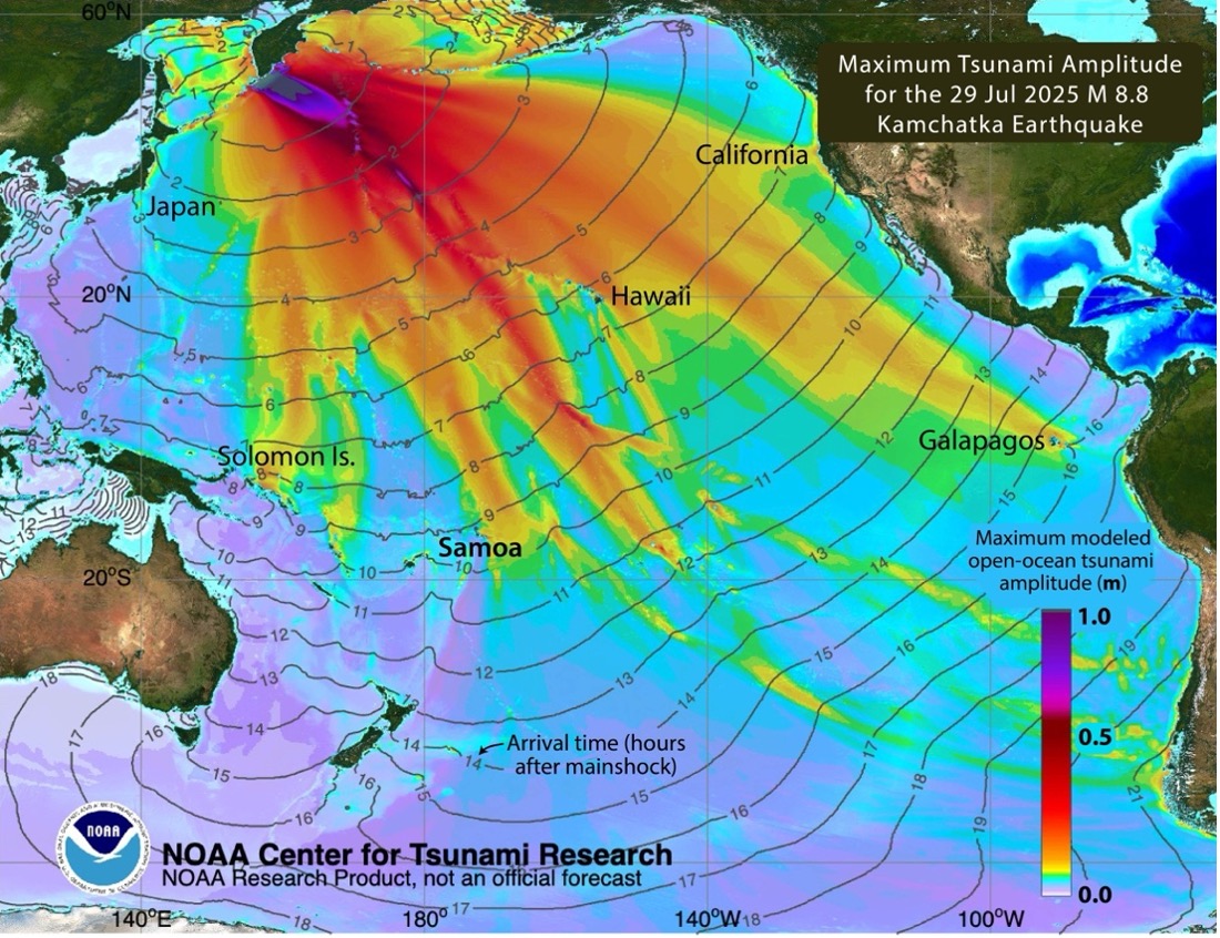
For instance, the July 29th Kamchatka earthquake, a magnitude 8.8 megathrust event, triggered tsunami warnings and evacuation alerts around the Pacific rim, including to Russia, Alaska, the West Coast of the United States and British Columbia, Japan, Chile, Ecuador, New Zealand, and Pacific Island nations. The first waves took approximately eight hours to cross over 3,000 miles of Pacific Ocean to reach Hawaii’s shores and another four hours to arrive on the beaches of Oregon and California. Because of the efforts of tsunami scientists to provide forecasts, populations and governments had time to prepare.
Geodetic Improvements Enhance the Accuracy of Early Warning Systems
In the case of very large earthquakes — magnitude 7.5 and above, earthquakes that are associated with some of the most destructive tsunamis — the current early warning systems may struggle in those first early moments to accurately capture the size of an earthquake.
“In the first seconds of recording seismic waves, it’s hard to tell if it’s going to be a magnitude 9 or magnitude 8 earthquake,” says Quentin Bletery, a geophysicist at Cote D’Azur University in France. For example, the massive Great Tohoku earthquake in 2011 produced a devastating tsunami in Japan. The earthquake’s initial magnitude was estimated at 7.9, before being upgraded to its eventual magnitude of greater than 9.0.
Tsunami-producing earthquakes sometimes add another layer of complication to offering accurate warnings. A 2006 tsunami earthquake in Java, for instance, caused minimal shaking but produced a seemingly disproportionate tsunami that killed hundreds of people and displaced many thousands more.
In the decades since, scientists have been developing more precise tsunami warning methods. Satellite technologies are one piece of the puzzle for faster and more accurate tsunami early warning. GNSS and GPS data can provide more exact measurements of ground displacement in the moments after a large earthquake, which can reveal important information about the changes on the seafloor that may lead to a tsunami.
Capturing seismic and geodetic data together is an exciting direction that tsunami early warning is taking, Hirshorn notes. In fact, geodetic algorithms are already being used by ShakeAlert to constrain large earthquakes. By combining GNSS data with seismic data, researchers can identify more precise and real-time ground shaking and movement — data which are especially helpful for understanding the size and scope of a tsunami-producing earthquake or a very large earthquake that may overwhelm one set of sensors alone.
A tiny signal offers new insights
Another avenue of tsunami warning possibilities comes from even tinier waves. Prompt elastogravity signals, or PEGS, “are gravitational perturbations generated by the mass movement of the earthquake and travel at the speed of light,” says Celine Hourcade, a post-doctoral researcher from Nantes University, and one of the authors of the new study presented at the 2025 EGU general assembly. The study suggests that capturing information from the PEGS waves will yield much more accurate magnitude estimates — and subsequent tsunami warnings — for large earthquakes.
“We hope to get the magnitude and location estimation to show the difference between magnitude 9 and 8, and based on that, we hope to make tsunami warning more efficient,” says Bletery, one of the study’s coauthors.
PEGS are recorded before the initial P-wave arrives at seismic stations. These waves are extremely small—“about a million times weaker than the shaking we usually detect,” Hourcade says. Instead of analyzing the P- and S-waves as they arrive, this technique would mean isolating and extracting the short time window before the P-wave arrives, Hourcade notes. That time window is where the PEGS signal exists.
“This brief moment, between the origin time of the earthquake and the arrival of the P-waves, is typically ignored in classical systems, but it carries incredibly valuable information,” Hourcade says. “In tests on past earthquakes in Alaska, our model was able to estimate the magnitude of earthquakes as large as magnitude 7.6 or more in under two minutes, much faster and more accurately than current tsunami warning methods, which sometimes take 10 to 20 minutes to deliver the first alert.”
Currently, researchers from this study are partnering with the Instituto Geofísico del Perú to implement their deep learning model in tandem with Peru’s existing tsunami warning system. This new PEGS-based model runs in real-time and should be able to detect and estimate the magnitude of large earthquakes within five minutes.
“This marks the first operational use of PEGS for real-time tsunami early warning,” Horcade says, “with the potential to significantly enhance tsunami preparedness in a highly exposed region.”
Copyright
Text © 2025 Temblor. CC BY-NC-ND 4.0
We publish our work — articles and maps made by Temblor — under a Creative Commons Attribution-NonCommercial-NoDerivatives 4.0 International (CC BY-NC-ND 4.0) license.
For more information, please see our Republishing Guidelines or reach out to news@temblor.net with any questions.