By David Jacobson, Temblor
Click Here for Spanish Version
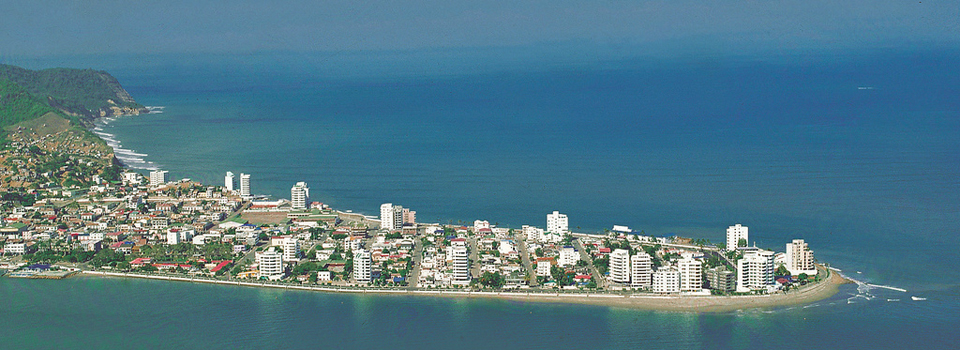
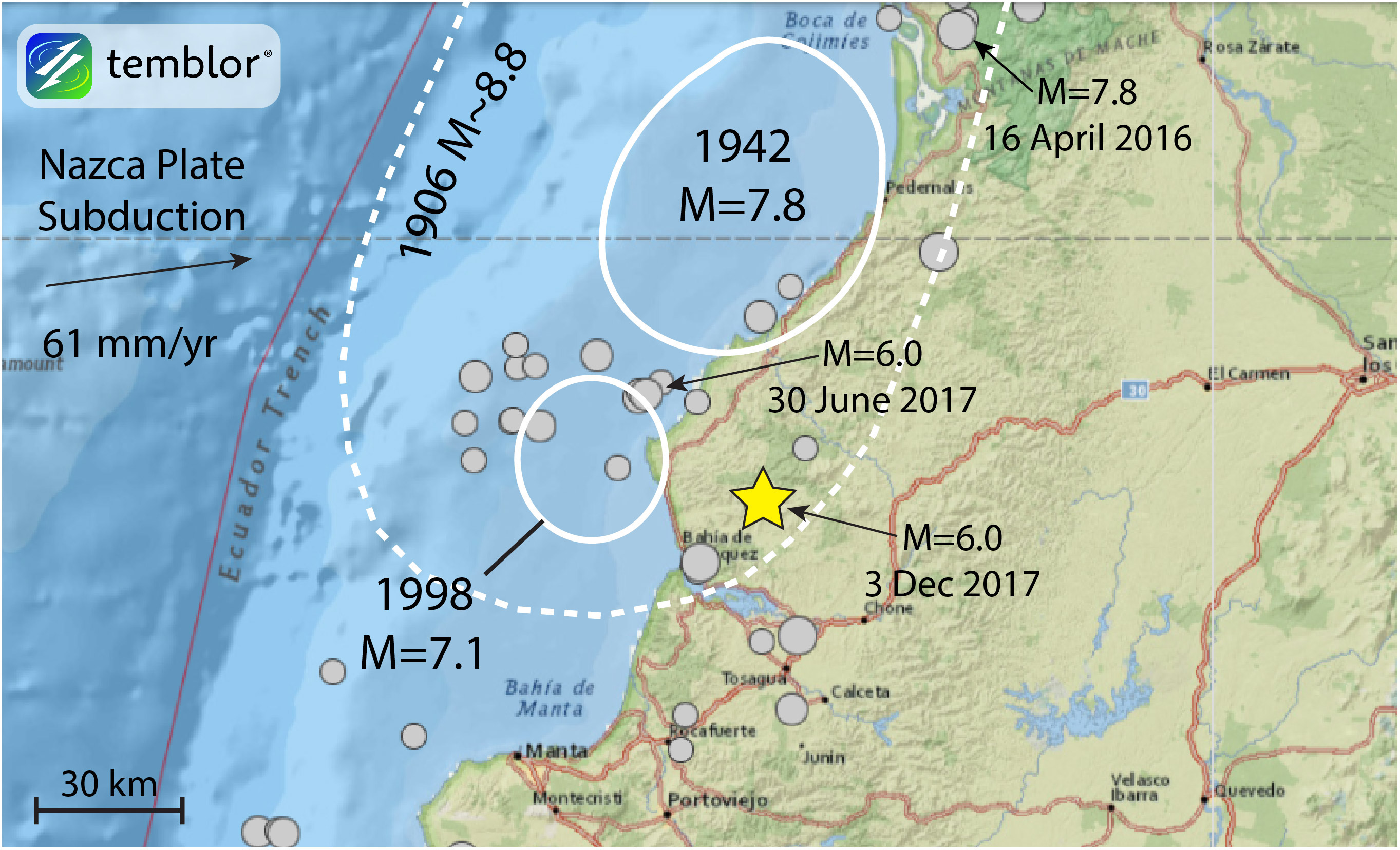
Yesterday, at 6:19 a.m. local time, a M=6.0 earthquake struck coastal Ecuador, near the holiday destination of Bahia. According to the President of Ecuador, there are no reports of damage or fatalities. This region of Ecuador is susceptible to large earthquakes, having experienced a M=7.8 on April 16, 2016, which killed over 600 people and caused an estimated $3 billion in damage. In addition to this large quake, just over five months ago, another M=6.0 occurred just 30 km northwest of yesterday’s epicenter. Based on their similarities, today’s quake and the one five months ago can be considered twins.
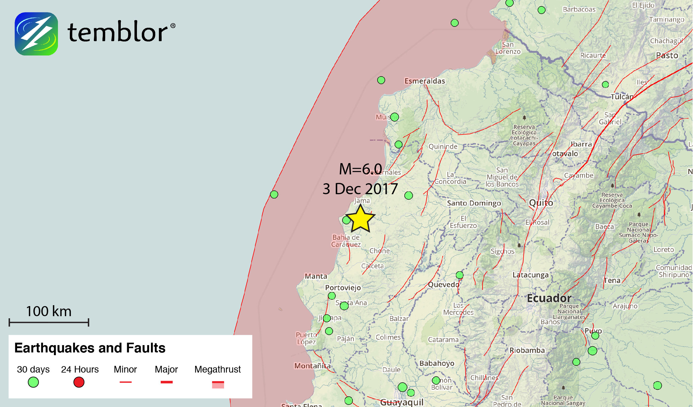
From the depth (25 km), and focal mechanism of yesterday’s earthquake, we can say that it either occurred on or directly above the subduction zone, where the Nazca Plate subducts beneath the South American continent. Similarly, the M=6.0 at the end of June also had a compressional focal mechanism, and struck on or just above the subducting slab. In addition to these twin earthquakes, the map below illustrates the numerous large shocks to hit coastal Ecuador in a little over a century. This map highlights the rupture areas of large, historical earthquakes, and shows that yesterday’s earthquake occurred within the rupture area of the 1906 M=8.8. The earthquake in 1906 triggered a deadly tsunami and killed over 500 people. It should be pointed out that just to the southwest of the epicenter of yesterday’s earthquake is the holiday destination of Bahia, which is extremely susceptible to tsunamis.
Based on the Global Earthquake Activity Rate (GEAR) model, which is available in Temblor, yesterday’s M=6.0 earthquake should not be considered surprising. This model uses global strain rates and seismicity from the last 40 years to estimate the likely earthquake magnitude in your lifetime anywhere on earth. From the model below, one can see that the likely earthquake to take place in this region in your lifetime is M=6.75+. To view the interactive GEAR model, click here. Therefore, despite the fact that yesterday’s earthquake did not cause any damage, it does bring Ecuador’s seismic hazard to the forefront.

Reference
USGS